Monitoring Volcanic Hazards...Europe


Renewed volcanic activity at the Phlegrean Fields tracked by Envisat
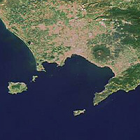
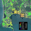
Using Differential SAR Interferometry (DInSAR), scientists at the Institute for the Electromagnetic Sensing of the Environment (IREA) of the Italian National Research Council (CNR) mapped the changes in the caldera – a ring-shaped region which includes several volcanoes – and discovered the area has uplifted about 2.8 centimetres from 2005 to 2006.
ESA Portal - Protecting the Environment - Renewed volcanic activity at the Phlegrean Fields tracked by Envisat
Hot stuff – 15 years of satellite data over Mt. Etna


No comments:
Post a Comment